


Self-guided motorcycle tour GPX routes are transforming how adventure riders explore the world. With GPX navigation, you bypass group tours and scheduled stops, harnessing digital tools to plan, download, and follow unique motorcycle routes—even when riding far beyond cell coverage. Here’s how to master this independent, modern approach to motorcycle touring.
Key Takeaways
- Self-guided motorcycle tour GPX routes offer freedom, customization, and cost savings over traditional guided tours.
- The right apps—like Calimoto, Kurviger, Scenic, and REVER—let you find, download, and navigate GPX files even offline.
- With the right prep, planning, and a few pro tips, you can confidently explore remote roads you’d otherwise never discover.
Table of Contents
Why Self-Guided Motorcycle Tour GPX Routes Are a Game-Changer
Self-guided motorcycle tour GPX routes flip the script on traditional group tours. Instead of following a paid guide or sticking to a rigid group schedule, you have the power to plan every mile your way. This approach isn’t just about freedom—it’s about authenticity. You decide when to start, where to detour, and how fast or slow to go. GPX file-based touring lets you:
- Ride at your own pace, stop anywhere, and adjust plans on the fly.
- Customize routes to suit your riding style and comfort with terrain and distances.
- Cut costs—no guide or agency fees, no forced hotel or restaurant choices.
- Maximize riding time on the exact roads you want—by downloading and curating your own adventure.
According to leading navigation apps, “All Calimoto, Kurviger, Scenic, REVER let you plan routes on a desktop or in-app, export the finished GPX to any GPS device or smartphone, and work without cellular data once the maps are cached, making them ideal for planning and navigating self-guided adventure tours.”

Where to Find and Download Motorcycle Route Files
Finding the right routes is key to great self guided adv tour planning. There are several practical sources for high-quality GPX files:
- Community-Driven Route Libraries: Scenic features a “vast database of thousands of beautiful routes, shared and rated by local Scenic users worldwide. Select an area, tap ‘Search’ and see what comes up.”
- Official ADV Forums: Websites like ADVrider and regional Facebook groups often have free GPX route threads.
- Touring Clubs & Moto Apps: Both free and paid sources exist, but even premium apps (like REVER and Calimoto) let you view, export, and sometimes interact with curated routes posted by other riders.
Many riders also share their own GPX track collections or export them from planning sites like MotoMap, Komoot, or even Google My Maps (converted to GPX). Remember to always read recent ratings and verify that the route matches your bike’s capabilities and your personal risk preferences.
Want to tackle more rugged or off-grid rides? Combine your GPX route with strategic gear—like a heated vest for cold mountain passes or an electronic earmuff for noisy highways.
The Best GPX Route App for Motorcycle Touring
Today’s best GPX route app for motorcycle touring depends on your riding style, feature needs, and preferred device. Here’s a quick overview of the top contenders:
| App | Best For | Offline Navigation | GPX Import/Export | Unique Feature |
|---|---|---|---|---|
| Calimoto | Curvy road lovers | Yes, global offline maps | Yes, .gpx/.itn/.kml | Curvy & extra-curvy modes, built-in POI |
| Kurviger | Custom planners | Yes, flexible offline map manager | Yes, .gpx/.itn | Cloud sync, glove-optimized |
| Scenic | Route discovery & sharing | Yes, in-app downloads | Yes, seamless import/export | Social route database, round-trip generator |
| REVER | Group rides & stats | PRO only | Yes, multi-device sync | 3,000+ curated trip maps, friend tracking |
As per market stats, “Calimoto and Kurviger both offer dedicated motorcycle-optimized routing with ‘curvy’, ‘extra-curvy’ and ‘fastest’ modes, the ability to import .gpx, .itn or .kml files, offline map packs for worldwide coverage, glove-friendly voice-guided turn-by-turn directions, and POI databases.” No matter the app, always check if the offline map feature is fully unlocked and compatible with your device before heading out.
If you’re prepping for tech-heavy solo expeditions or group rides where navigation reliability is paramount, consider combining your app with a secure GPS navigation mount for your handlebars.
Planning Your Self-Guided ADV Tour: Step-by-Step
Your ideal self guided adv tour planning workflow:
- Find Your Route: Use Scenic, Kurviger, or ADV forums to scout downloadable GPX routes. Check rating, recency, and rider reviews.
- Download the GPX File: Get the file directly onto your desktop or phone. Some platforms allow direct “Open in App.”
- Preview and Edit: Open in your navigation app and review the route. Edit or add custom waypoints to bypass or include specific spots.
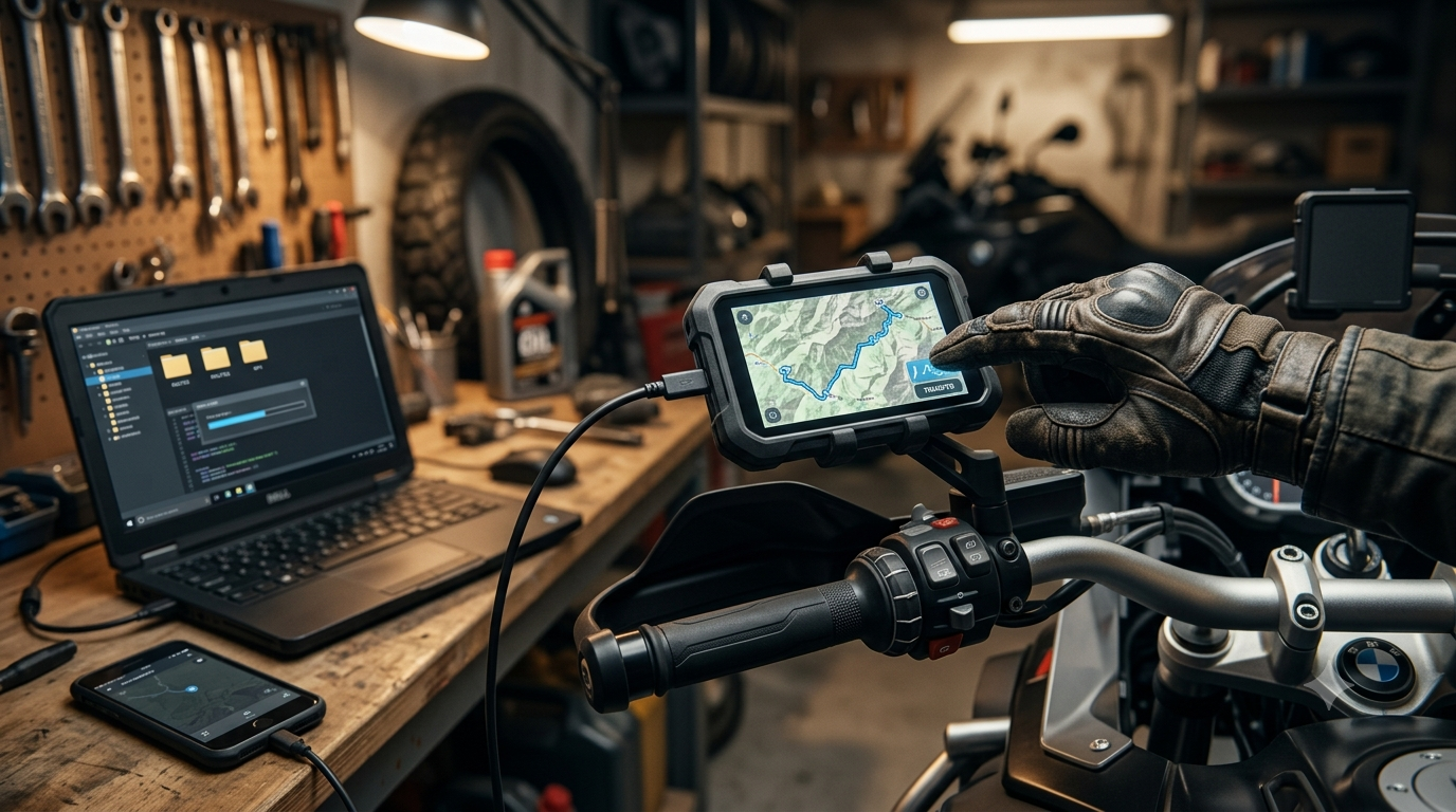
- Export/Import to Device: Transfer the finalized GPX to your phone or standalone GPS. Most apps support wireless import, cloud sync, or even simple drag-and-drop via USB or AirDrop.
- Activate Offline Navigation: In-app, select and download all required map tiles covering your route and backup areas.
- Test and Go: Preview key junctions and route segments. Run a simulation or short shakedown ride. Then, you’re ready to ride—even where there’s no cell service.
For more on smart packing, check out our adventure motorcycle camping gear guide for ultralight, moto-specific packing recommendations.
Offline Navigation: Staying on Track Without Cell Service
No data, no problem. Offline route navigation app moto features are your safety net in remote regions. Here’s how it works:
- Map Packs: Download all maps you need before departure. Good apps let you select regions or even whole countries, and manage them for space efficiency.
- Voice-Guided Directions: Both Kurviger and Calimoto shine here, giving turn notifications you’ll actually hear through a helmet headset.
- Usable While Wearing Gloves: On-the-go, you want to minimize taps. Look for big buttons or set up your phone with a glove-friendly screen protector.
- Battery Management: Offline mode conserves battery, but always pack a backup power bank and short charging cables. Display brightness and GPS are major drains.
“Kurviger offers you voice-guided navigation that leads you safely and reliably to your destination – anywhere in the world! … Use offline maps and manage them easily in Kurviger’s practical offline map manager so that even a dead zone can’t stop you.”
Pair your navigation with a proven action camera to log your ride or pick up a set of soft panniers for more off-grid flexibility.
Pro Tips for Next-Level Self-Guided Motorcycle Touring
- Route Customization: Don’t just follow a track—edit GPX files with your rest stops, scenic detours, or essential fuel points. Most apps support detailed waypoint editing.
- Community Ratings Matter: Before committing to a long route, always scan recent ratings or comments from local riders for obstacles, construction, or closures.
- Multi-Device Export: Save your route to both your phone and a USB stick, or load it onto a backup GPS unit—redundancy saves trips.
- Real-world Tuning: “I download Ride routes and open them in GPX viewer on my phone. I also tweak and build my own online and export them, then refine over time.” (source)
- Stay Protected: Riding solo or remote? Prioritize proven safety gear like a Bluetooth motorcycle headset and a lightweight crash bar setup.
It takes just a little prep to go from following the crowd to owning the adventure. Combine digital navigation with tested motorcycle packing strategies for real independence.
Advanced Analysis & Common Pitfalls
Navigating self-guided motorcycle tour GPX routes has huge benefits, but some downsides and pitfalls aren’t obvious until you’re miles from home. Here’s what savvy riders watch for:
- Incomplete or Outdated GPX Files: Community-shared routes can be dated or have broken tracks, so always preview and cross-check your intended ride.
- Map Update Issues: Offline maps need regular refreshes. Download fresh versions before every major trip, check for app or firmware updates, and consider additional map providers for redundancy.
- Device Compatibility: Not all route formats work everywhere. Calimoto accepts .gpx, .itn, or .kml; Kurviger likes .gpx or .itn. Confirm before riding out.
- Battery and Overheating: High-brightness screens and constant GPS tracking sap battery life. Hot days can trigger device thermal cutoffs, leaving you without guidance. Use a sunshade or tank bag window for extra protection.
- Navigation App Bugs or Crashes: Even the best apps can freeze or fail, especially on older phones or after OS updates. Save backup paper maps in your tank bag, just in case.
If you tour in mosquito-heavy zones, add a tough mosquito repellent to your kit list.
| Pitfall | How to Avoid It |
|---|---|
| Outdated GPX routes | Preview every route, check community feedback, update maps before leaving |
| Offline map gaps | Download extra map coverage and adjacent regions for bailouts |
| Battery drain or phone overheating | Carry power banks, use shade, minimize screen time |
| GPX file incompatibility | Test import on all devices before the trip |
| App crashes | Have secondary device or paper map as backup |

Conclusion
Self-guided motorcycle tour GPX routes let you ditch the group and ride your own way—at your tempo, with your preferences, and on your own terms. With the right combination of route sources, offline map prep, and a few hard-earned tricks, your next moto adventure is limited only by your ambition. Whether you’re aiming for winding backroads, international trails, or just a scenic day trip, now’s the time to put self-guided motorcycle tour GPX routes to work for you.
Ready to upgrade your riding adventures? Start building and downloading your next GPX route today—and share your favorite tools or touring stories in the comments below.
FAQ
Can I use self-guided motorcycle tour GPX routes without cell service?
Yes, if your navigation app supports offline maps. Download the GPX route and all region maps in advance, and your phone or GPS device will work without data.
What’s the fastest way to find pre-made GPX routes for a new area?
Check community route libraries within apps like Scenic, or ADV forums for local recommendations. Always preview and verify route suitability before riding.
Are GPX route apps compatible with both Android and iOS?
Most top navigation apps (Calimoto, Kurviger, Scenic, REVER) have versions for both platforms, and GPX files are universally supported. Always check your device’s app store.
What should I do if my navigation app crashes mid-ride?
Have your GPX loaded on a backup app or device, and carry backup paper maps for true reliability—especially on multi-day, off-grid rides.
How often should I update offline maps and GPX files?
Before every trip. Map updates ensure accurate road info, while fresh GPX files keep you clear of new closures, restrictions, or hazards.